Tuesday, December 23, 2008

Hawaii: Backpacking - Day 1

This was the trail:


The plan was... to take 2-3 days on the trail. We were afraid of how long fording rivers might take, especially if there were any flash flooding, and we did not know how in shape we would be after finals and with little sleep beforehand, so we played it safe. The trail from the Waipio Valley Lookout to the Waimanu Valley was about 10 miles, give or take, and we wanted to make sure we set up camp before dark, especially since we really were not sure what the situation was going to be like there, and there were supposed to be about 8-9 rivers to ford.

The Original Plan
Tuesday, December 23: Drive from Hilo Bay Hostel at 8:00 am, drive to Waipio, park at Waipio Valley Artworks, hike to the Waipio Valley Lookout (~1 mile), begin at Waipio Valley, hike down and across the beach (~2 miles), and up the Z-trail (~2 miles). Total: 5 miles
Wednesday, December 24: Head out on the Muliwai Trail, get to Muliwai (~7-8 miles). Total: 7-8 miles
Thursday, December 25: Explore, come back on Muliwai Trail, celebrate Christmas (~7-8 miles). Total: 7-8 miles
Friday, December 26: finish Muliwai Trial back up to car (~5 miles), drive to Kona, wee. Total: 5 miles

Day 1 did not turn out to be anything we planned.

We left Hilo Bay Hostel around 7:30 or 8:00 am, and the drive to the Waipio Valley Artworks parking lot only took about an hour or so, so we had arrived there by 9:00/9:30. We paid for parking, and was finishing the last of the packing and slathering of mosquito repellent and sunscreen, when an elderly couple drove up and started chatting, asking us where we were going, etc. While Mike was finishing up, I was telling them about our plans to backpack down the valley into the abandoned Waimanu Valley, etc. for a few days.

Elderly couple: So, how are you getting to the lookout?
Me: Walking, I guess.
Elderly couple: It's a long walk!
Me: I suppose, but it's not too bad considering how much else we are planning to do.
Elderly couple: Did you want a ride?

And so that was just awesome and fine and dandy, so we were saving time hitch-hiking with an elderly couple. Sweet.


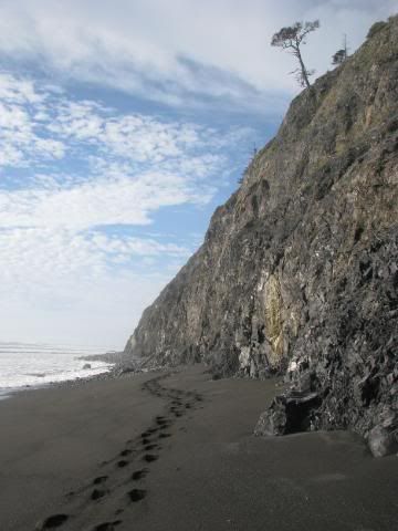
After saying our thank-yous and the likes, we headed down the road the descended into the valley. The first mile of the trail is on a paved road that heads into the valley. Only 4-wheel drives are allowed down there, seeing as it is a 25% grade down and up.


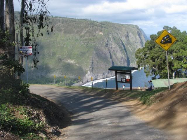
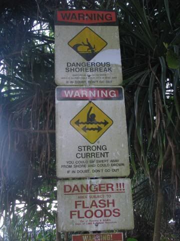
There were many warning signs at the head of the road, and all the way down to the bottom (you'd think that people would have turned back after a while. By that point, well, is there a point?)

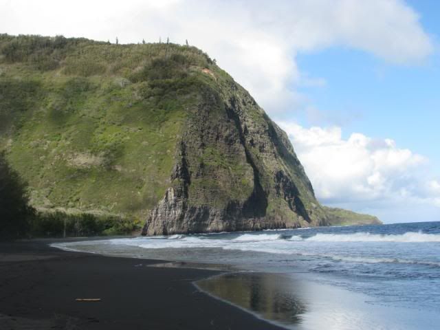
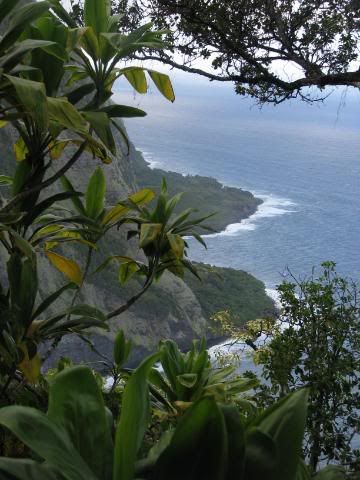
The walk down was cool, even if it was on a paved road. You could see the root system of the trees, and had a great view of the Waipio Valley, and the very daunting Z-Trail.


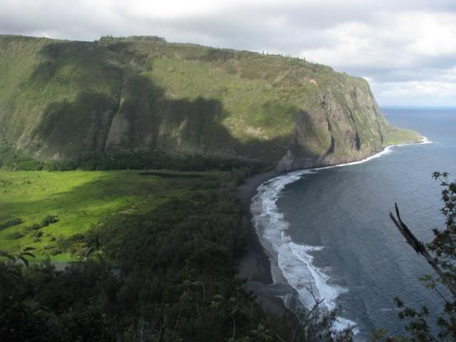
If you look very closely, you can see a little zig-zag trail going up that mountain. That, my friends, is the Z-Trail. About a mile long with an elevation change of about 1,300 ft.

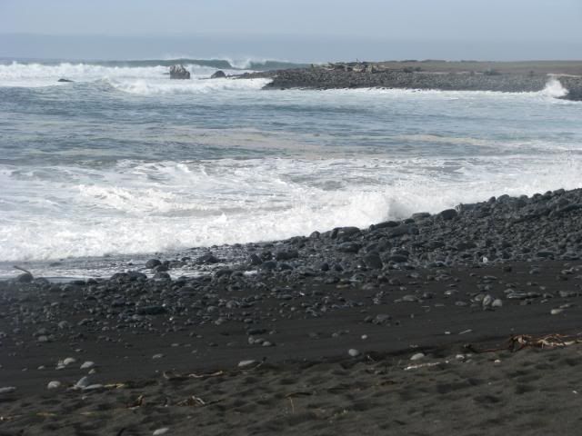
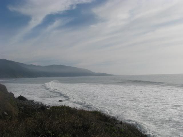
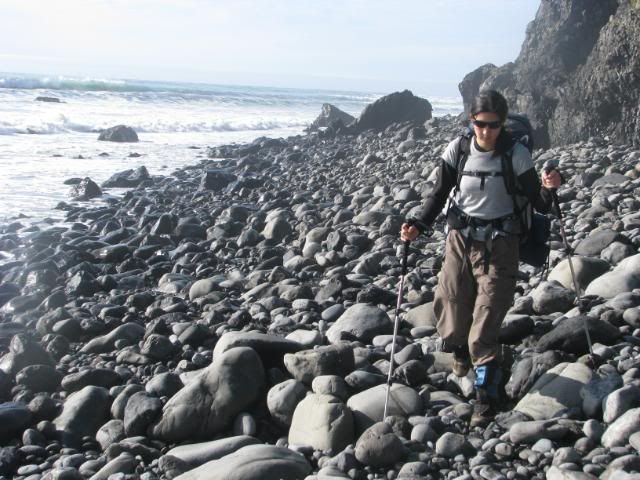
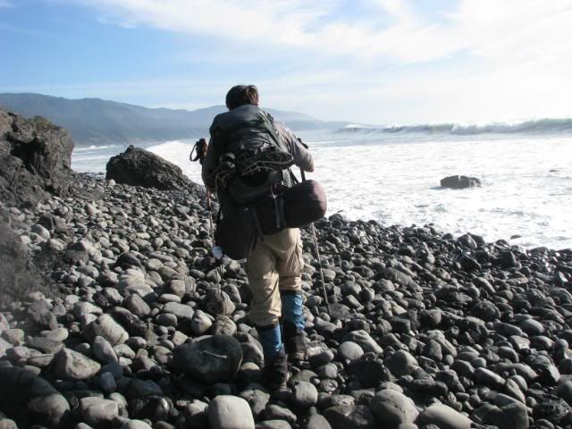
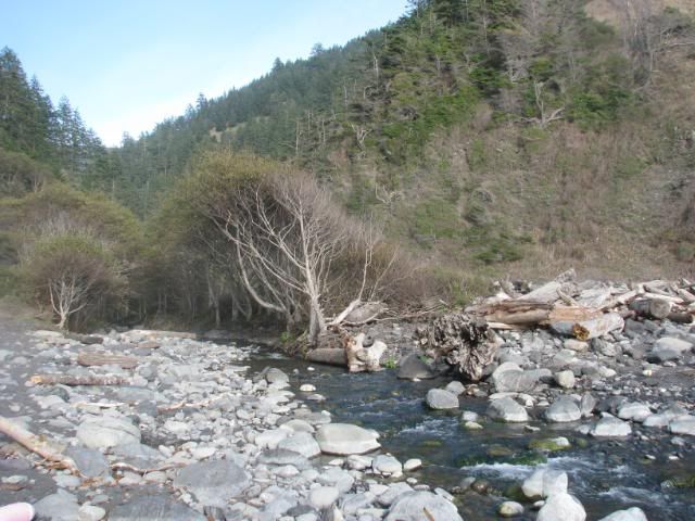
Soon after heading into the valley, it was time to ford our first river! It was actually really annoying, because it was a pretty swift-moving stream that was pretty wide, and got pretty deep. There were a bunch of surfers there who I swear were laughing at us. They told me that I needed to walk out into the ocean, and there was a sandbar there, and I just needed to go far enough, but not too far. Feeling really awkward with 35 pounds on my back and REALLY not wanting to get wet within the first mile or two of the trip, I gingerly walked into the ocean. I guess I didn't go far enough, or whatever, but they kept on telling me to go further, but then they gave up on me in the end. Hey... I have lots of weight on me and clothes I don't want to get wet! Oh well, I made it mostly dry in the end. ...It's easy for them to say, they're wearing swimsuits and carrying surfboards.

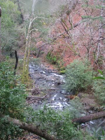
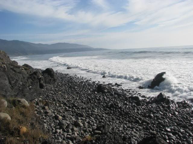
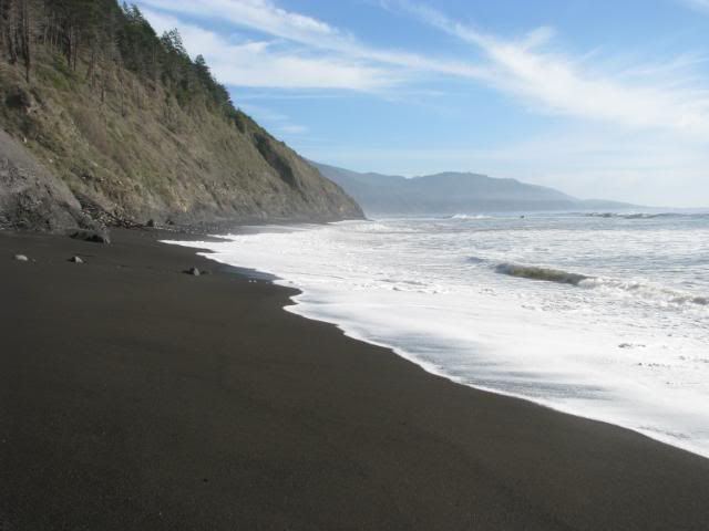
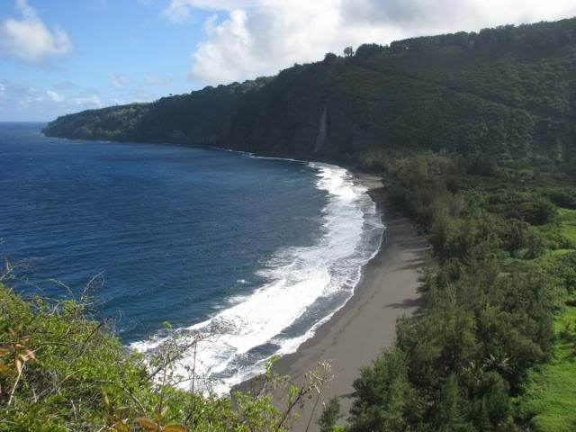
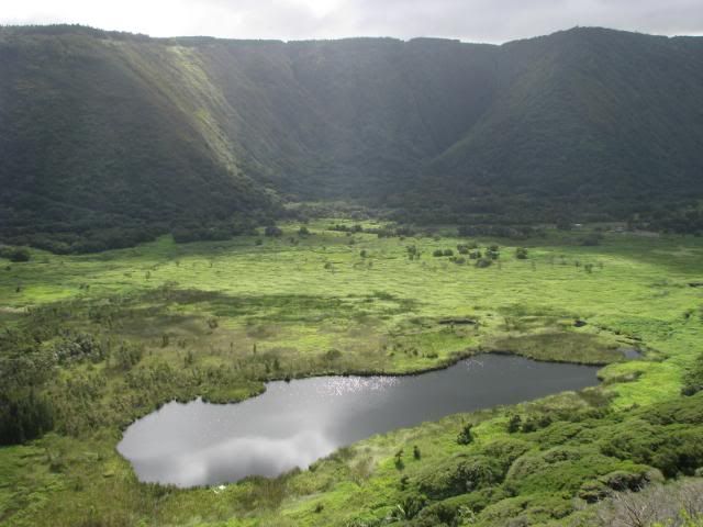
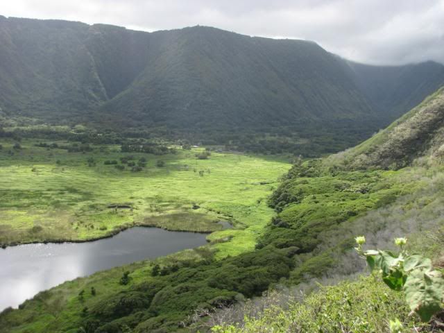
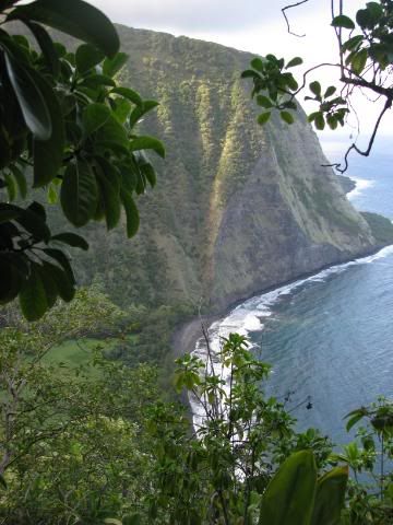
A look into the Waipio Valley.


You can see the Z-Trail a little better here:


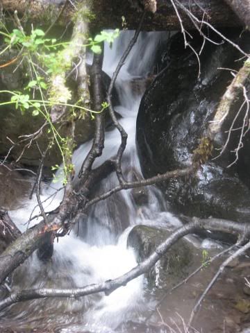
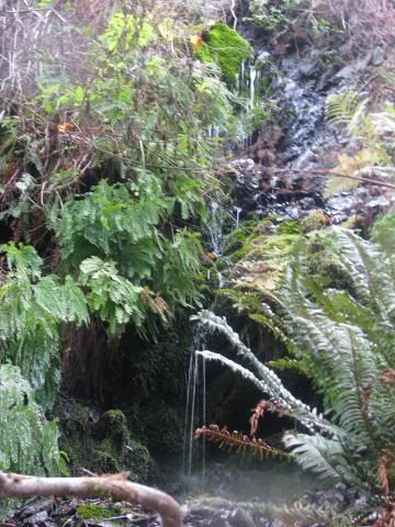
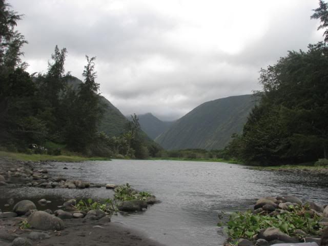
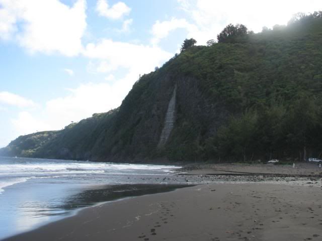
After crossing the stream, you're supposed to be able to see a waterfall. Unfortunately, Hawaii had not been getting much rain at this point, so there was just a dry waterfall.


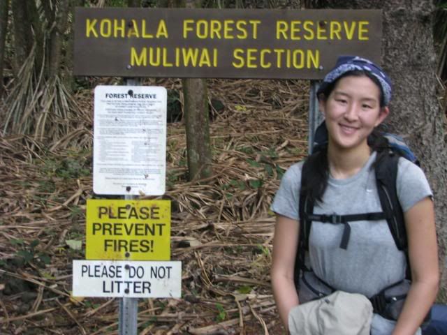
The beginning of the Muliwai Trail! Woo!


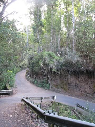
So we headed up the Z-trail around 11:00 am. It wasn't as bad as I thought it would be. It was a pretty well-maintained dirt trail that just basically went back and forth, so I was able to get some nice pictures of the valley on the way.


I'm lovin' the sunlight.


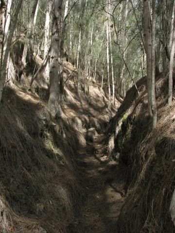
So near the top of the Z-trail part of the Muliwai Trail, you come across this mini forest of ghostly pine trees with a blanket of pine needles on the ground. It's pretty creepy.


Somewhere in the there, we had lunch, and realized it was the only place we had reception since Hilo (we called the parentals to reassure them that we were still alive).

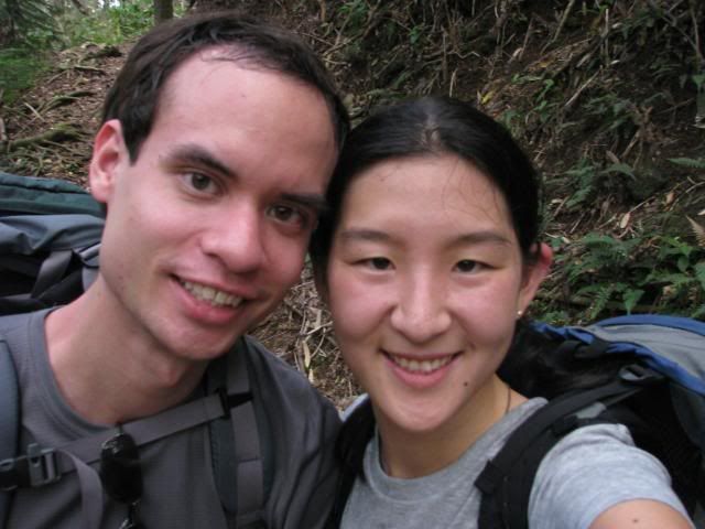
We have hats! (And I'm out of focus!)


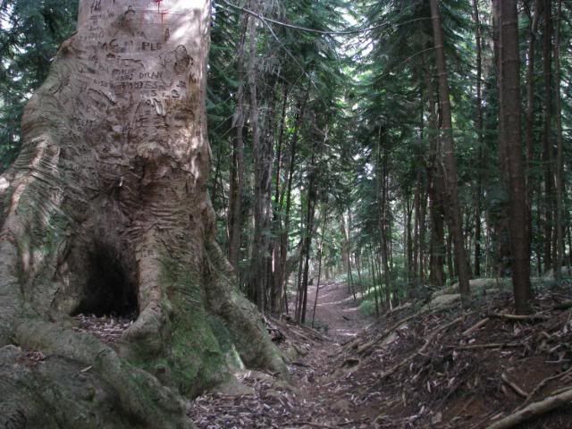
It makes me sad what people do to trees.


More dried waterfalls, what?


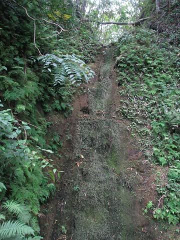
So this was very disappointing. Part of the reason why I wanted to go to Hawaii and go hiking and backpacking in the area was so I could see the waterfalls! What the heck? All I get are a bunch of mossy, buggy dried up rocks. The bright side of this is that, now, we don't have to worry about fording 9 rivers and be scared about flash floods. The bad news is that there was no water between the head of the trail and the end of the trail where the last campsite was! Well then, I guess the only thing to do is to finish the 10-11 miles and set up camp (hopefully before dark).

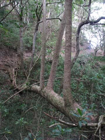
Crazy tree that fell across a gorge and had branches that grew like tree trunks.


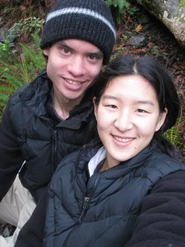
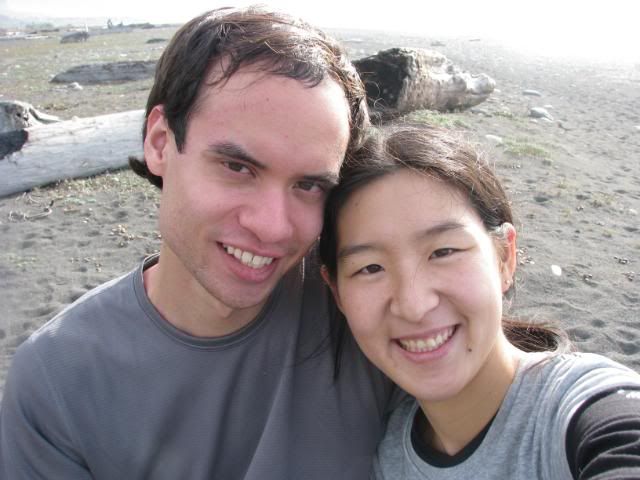
Now you get a shot of our ugly, out-of-focus mugs. :)


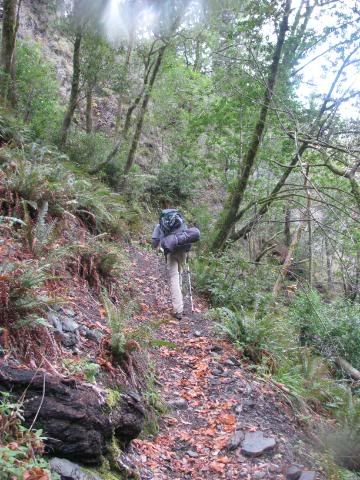
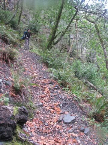
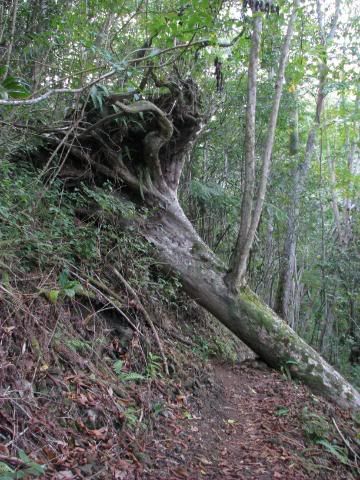
There were a few fallen trees that we had to maneuver over/under/around. (Much more over and under and much less "around" unless we wanted to fall down the hill, wee!)


Is it Waimanu Valley??


Alas, no it was not.

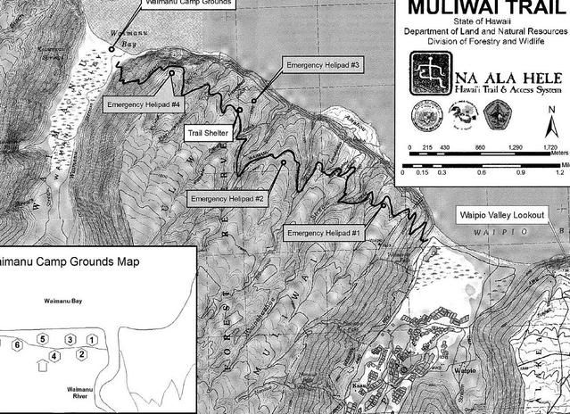
Our progress on the trail wasn't as bad as we thought it would be, though. We made it to the top of the Z-trail and had lunch, which took until about 1:00 pm. We made it to Helipad #2 at 2:00, Helipad #3 around 3:00, and Helipad #4 around 4:00 (kind of weird, I know). At Helipad #4, it was the top of the trail down to Waimanu Valley, and it was onl 0.9 miles away from the campgrounds.

Great! We had been going about 1.5-2 miles an hour, and this was less than a mile down. We should be getting down in no time at all with plenty of light to spare to explore a little, set up our new tent, cook dinner, watch dusk fall, etc.

Yeah, right.

The last mile was the longest mile ever. Every 10 steps would be a massive spider web (along with spiders!) that would span across the trail. They were all lovingly at head-height as well. If you know me, you know that I had small(ish) spiders and spiderwebs. I can do large bugs like huge cockroaches and tarantulas, but I can't do spiders the size of a nickle... I imagine them climbing into every random orifice on my body. Anyhow, so the 0.9 miles took a whole hour of knocking down spiderwebs (thank god for hiking poles!), maneuvering around parts of the trail that had eroded into the cliff side, taking a few pictures, and knocking out more spiderwebs.


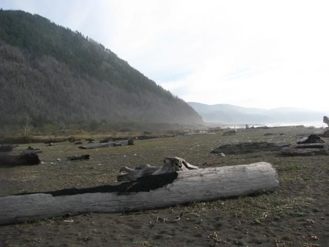
We got to the bottom, finally! Wee.


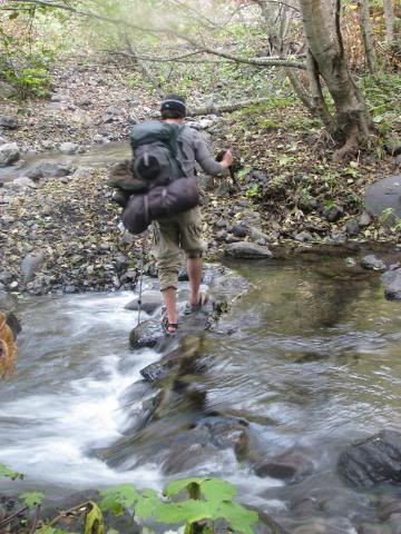
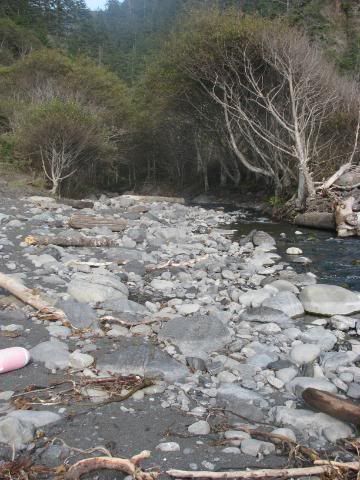
Haha, and then we had to cross the river.


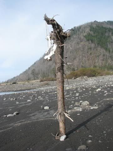
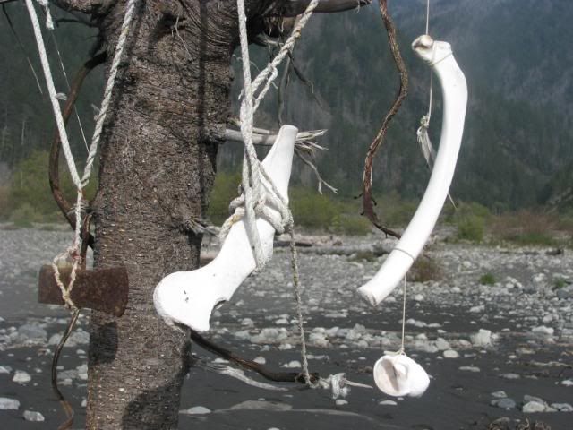
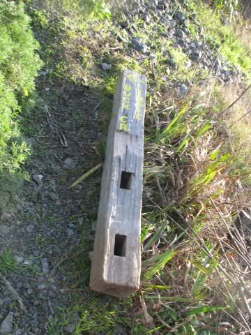
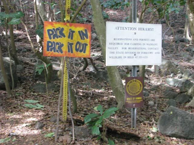
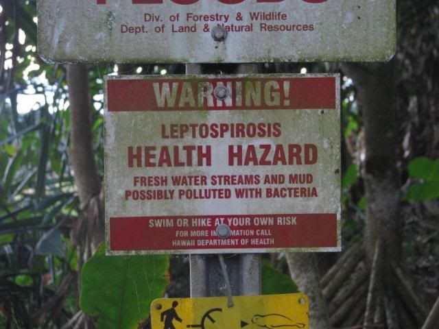
Of course, right before you cross, you come across a pole with a billion signs on it:


As if THAT wasn't enough to give you the shivers, there is also a memorial for those who had died on the trail--crossing streams or otherwise.


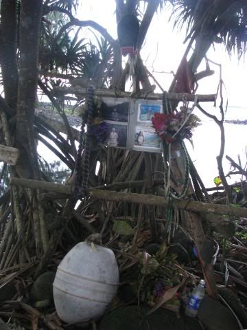
That's not scary at all!

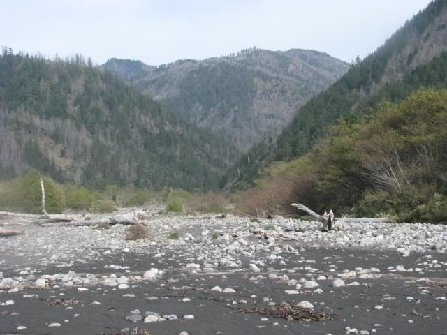
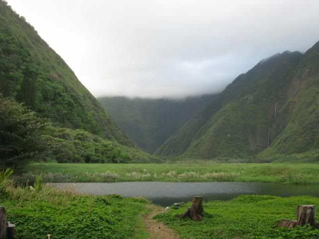
In the end, we made it across, and was rewarded with a beautiful green valley with the clouds rolling in. (Ignoring the human trash, of course.)


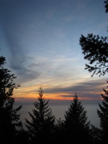
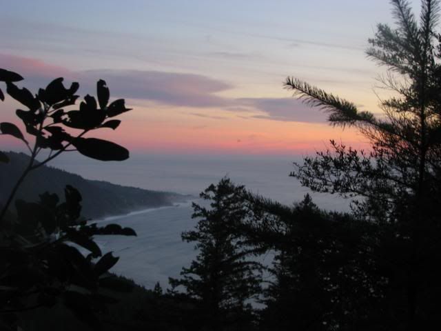
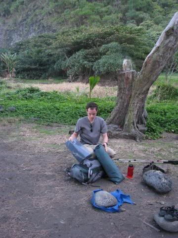
We set up camp, cooked dinner, and crawled into the tent, and got ready for a windy, rainy night.


Since there is no electricity, it's an early night. ...More or less, if we ignore the wind and the rain that began to come down, making us feel like our tent was about to collapse on us at any moment in the middle of the night.

Monday, December 22, 2008

Hawaii: TSA, you lose

Guess what we found in our luggage that we forgot to unpack?


It was hiding in our pot and we completely forgot that it was in there when we packed up the pot. Yes, TSA did not see our gas stove that was inside our little pot. You silly TSA people. And you worry about our water bottles and our grannies with knitting needles.

Hawaii: Leaving

So. Mike and I were looking around trying to decide the best place to go backpacking in the smack dab middle of winter. We finally settled on the Muliwai Trail that goes between the Waipi'o and Waimanu Valleys on the Big Island, Hawaii, HI.

Here's the rub: We needed to find the time between (a) the end of my finals (Dec 20) and (b) the beginning of Mike starting his work at Dreamworks (Jan 5, yay!). Taking airfare into account, and all that fun stuff, the final call was to fly out on the morning of the 22nd (around 9:00 am) and arriving at 5:30 am or so on the 31st. ...This means that there was less than 48 hours between the end of my last final (ended at 3:30pm) and the flight to fit in (a) baking a ton of cupcakes and cookies for people for Christmas, (b) have lunch with the dance girls since one of them was visiting from Germany, (c) having dinner with my parents, (d) go to Mike's parents' place to get a ride to SFO in the morning, and, oh yeah, (e) PACK.

For the most part, things were done. Cupcakes and cookies were done for the most part, lunch was fun, dinner was good, packing managed to be stuffed somewhere in the nooks and crannies between everything, so all was well.

Maybe.

So apparently Mike and I are either really stupid, or I'm subconsciously sabotaging our trips so I can have something exciting to blog about.

Here's the exciting story of our leaving.

We made it back to Mike's parents' place, backed up my laptop since we were planning on taking it, repacked a little since we needed another luggage to fit our sleeping pads and hiking poles in (TSA would probably not appreciate all of that danging off our backpacks), and then it was already 1 in the morning. The plan was to wake up around 5:30 in the morning, leave at 6:30, get to the airport at 7:00 or so with enough time to check in bags, go through security, get some breakfast, and relax before boarding the plane. ...Or so was the plan.

We were able to get to the airport a bit after 7:00 am, saw the ridiculous holiday travel lines, groaned, and got in line at US Airways. We had booked our tickets through Orbitz, and it showed that it was a US Airways flight, which was not preferred, but oh well, what can you do. After waiting in line for about 20-30 minutes, Mike turns to me and goes "Oh. My. God. OUR TENT."

Yes, ladies and gentlemen, Mike and I forgot our beautiful tent. Our beautiful tent that would protect us from Hawaii's winter rains, mosquitoes, and centipedes that apparently emerge during the rains and have REALLY painful bites. Yay. We being panicking, call Mike's parents and ask them to please turn back to the airport, and began wondering if we can make it back to Berkeley in time to get the tent (it being Monday morning at 7:45 in the morning), if his parents could ship us the tent, or what we could do. The problem was multi-folded: (1) we love our beautiful 4-season tent, (2) Hawaii was supposed to be raining like the dickens, and we did not want to be trapped without shelter, (3) everything in Hawaii closes at like, 5 pm, and our flight landed at 4:56 pm, (4) we are planning to leave at bright and early 7:30 or 8:00 in the morning to drive from Hilo to the Waipi'o Valley area because it was, according to most things we read, about an hour and a half drive, then we had to park at some store, pay for parking, and then hike the next mile to the Waipi'o Valley Lookout itself, and then proceed to hike down and up really steep hills, yay. So there was that.

All in the mean time, we stay in line at US Airways, and finally get to the counter for the self check-in kiosk things, sign in, and then the screen flashes that the flight was being flown by United.

United was not in the same terminal at US Airways. In fact, it is in another terminal basically on the other side of the airport.

What. The. #$%@.

So after waiting around for about 5 minutes for somebody to help us and confirm that our flight was indeed at United now, no help came, so Mike's dad (who had arrived at this point), showed us the underground passageway (i.e. the parking lot) to the other terminal, got there, and cried a little at how long the lines were and at how little time we had before the plane took off (about 45 minutes).

Mike was finally able to flag down somebody, I run over to his side of the terminal, toss our bags down, and run to the security. The security line looked long, and we told the person up front that our flight was to leave in 35 minutes or so. Apparently she thought we had time. To my surprise, it was actually a lot faster than I thought it would be. Still, we had to run through, rush to the restroom, and run to the gate. We got there just as the people were calling our names at the little desk in front of the gate, got our tickets, and boarded (they had already begun boarding).


We landed in Honolulu, had a 4-hour layover wherein we were able to get a roasted 1/2 chicken with veggies (yum), look at all the warnings about bringing flora and fauna from the mainlain to the islands and vice versa, and read a little.


We finally landed in Hilo, and, oh yeah, we still don't have a tent huh? So Mike's dad had convinced the Hilo Surplus Store to stay open until 6:00 pm, so we hoped and we hoped and we sacrificed a little baby to the gods in hopes that we could get there

We landed around 5:00 pm, our luggage was right there when we got to the carousel, and time was on our side. Until we arrived at Thrifty, proceeded to wait 20 minutes for somebody to get to us, get lost trying to find our rental car, return the rental car because something was screeching that should be not screeching, got a really hideous bright blue PT Cruiser, and rushed over and got to the Surplus Store at around 5:58 pm. We picked up a tent, a gas canister for our stove, a lighter, met the nicest people on earth, and finally stopped at the Hilo Bay Hostel, checked in, drove to Safeway for some food.

That was that.

Here is a picture of the Mauna Kea Observatory from the plane.


Thanks for putting up with all the text. It will be mostly pictures, as usual, at this point.

Thursday, December 4, 2008

Lost Coast: Backpacking - Day 2

The next morning we woke up fairly early, but took our time. This was because there is a trail that is impassible as high tide, and high tide for the day was going to be around 11:00 am or so, meaning that we couldn't actually go on the last 2 miles of the Lost Coast Trail until 1:30 pm, at least.

The plan was this:
10:00-12:00pm: Hike out to the beach: ~2 miles
12:00-1:00pm: Hike along the beach until we reached the point where it was impassible at high tide: ~1 mile
1:30-3:00pm: Wait for the tide to go down, and finish the rest of the trail: ~2 miles
3:00-5:00pm: Hike up Buck Creek Trail and to the car: ~4 miles

You'd think that we would be able to finish around the right time, considering that 2 miles an hour is really not a fast pace at all. ...We were so wrong!

So we took our time in the morning... had some instant oatmeal, some fruit leather, refilled our waters, packed up the tent, etc.

We look so tired.


The continued Rattlesnake Trail out to the Big Flat was amazingly gorgeous. It was very full of trees and bushes, and best of all, little waterfalls!


We finally got to the next river crossing, and again, we were having problems finding a good place to cross. Amusingly enough, we ran across another couple of guys backpacking, and they were on the other side of the creek trying to get to our side. So after yelling our hellos and "Are you trying to cross?" over the sound of the water, we all came to the conclusion that the best solution was to take off our shoes and ford the river. Granted, the river wasn't too bad with regards to speed and depth, but it was still high enough to get into our boots if we tried to hop across.

Yay rushing water. It was very cold water.


Again, I have the camera. Wee!


We finally made it out to the beach around noon or so.


Cheesy shots!


The walk along the beach was definitely interesting... there were lots of make-shift driftwood shacks that people seemed to be living in. Most of the residents looked like surfers. Along with that were some really interesting creations...


Yes, those are bones.


The mountains were gorgeous, though, and so were the clouds and the waves. We reached the end of the trail before heading down onto the beach itself, but the tides were still high enough for the waves to crash against the cliffs, so we decided to wait a while.


Finally, after waiting about an hour until 1:30 or so, we were finally able to hike down to the beach.


By the way, rocks are a PAIN to walk on. I must have almost twisted my ankle hundreds of times by the end.


This one of my favorite pictures from the hike:


Jellyfish! There were many beached jellyfish.


So, according to the map, we had to cross about 3 creeks before reaching Buck Creek Trail (Buck Creek would be the third creek). We weren't very sure what was considered a creek, because there were lots of points along the trail where water was trickling down.

We finally reached one. It had already been an hour or so, but it was the first big creek/river that we had passed. It was very pretty, and came out of a tunnel of trees that looked like it was the entrance to the land of Narnia, or something of the sort. If it was Shipman Creek, then it was very disheartening since it mean that we basically spent an hour going only a mile along the Lost Coast Trail, and beach walking is very tiring.


Still, we trudged on, and began asking people along the way which creek it was since we had no clue at that point where we were. Nobody else seemed sure.

Finally, at 3:15 pm, we finally found the mouth of another river, and walked up a bit. There seemed to be a couple campsites, and it looked like it could be Buck Creek. We found a potential trail, and after a few meters, we finally came across the elusive Buck Creek Trail sign.


At this point, it was 3:30 pm, and we had 4 miles to go, and 3,500 feet to climb, so the pictures dropped off really quickly at this point. We were racing against sunset with really sore legs, 40 pounds on our back, and what must have been at least a 25% grade at some legs of the trip.

Of course, I needed to stop for some pictures of sunset/dusk.


We believe that is Shelter Cove out there.


After that, we continued to dash as fast as we could. Around 5:00, we came across the same guys that we ran across on Rattlesnake Creek Trail. They said that we had about another 1.5 miles to go, which means that it took us about a mile an hour, which was very depressing. By the last mile and a half, it became completely dark, we turned on our headlamps, and trudged along, needing to stop every 100 feet because our legs were about to give in. When we finally reached the intersection of Buck Creek Trail and King's Crest Trail, it was 6:15 pm or so, and we hurried our way along. Partially because we wanted to get home, and partially because I am apparently extremely afraid of the dark. I have watched too many X-Files episodes.

In the end, we finally reached the car around 6:45/7:00 pm, and got back to San Francisco around 1:30 am, and that was it. :)

It was definitely a rough trip. By the end, I could not feel my legs or my feet at that point. Still, it was an adventure pushing the last 4 miles, and I do not regret my decision. I hope to be able to go back and hike the entire Lost Coast some day!